From Factory Floors to Luxury Lofts: Adaptive Reuse as Illinois’ Quiet Real Estate Goldmine

Factory Floors to Luxury Lofts

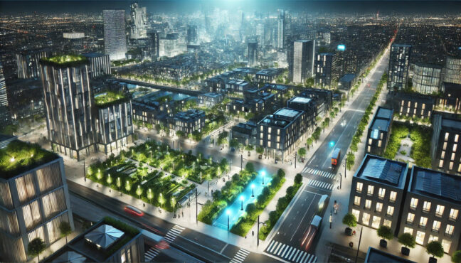
In an era when real estate headlines are dominated by glass towers in Miami and trophy conversions in Lower Manhattan, a quieter, more consequential transformation is unfolding hundreds of miles inland. Across Illinois, long-dormant industrial buildings—once engines of manufacturing power—are being repurposed into housing, offices, and mixed-use communities. The trend lacks the glamour of coastal megaprojects, but for developers willing to navigate complexity, adaptive reuse has become one of the Midwest’s most compelling, if understated, opportunities.


At the center of this movement is a simple but counterintuitive idea: the future of urban growth may depend less on building anew than on reimagining what already exists.


The economics of second lives


Adaptive reuse has long been romanticized as an architectural gesture—brick facades preserved, steel beams exposed, history turned into aesthetic. In practice, it is a financial strategy shaped by uneven markets, regulatory hurdles, and the hard arithmetic of construction costs.


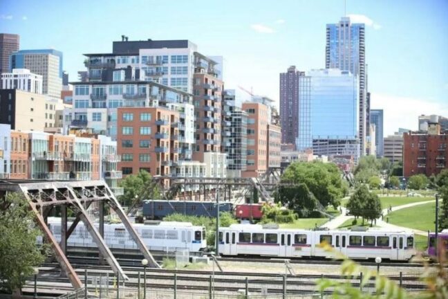
Illinois, particularly outside Chicago’s downtown core, presents a distinct equation. Acquisition prices for former factories, mills, and warehouses remain relatively low compared with coastal cities, reflecting decades of industrial decline and population stagnation. That discount is the entry point. What follows is anything but simple.


“Adaptive reuse looks cheap on the spreadsheet until you start opening walls,” says Hirsh Mohindra. “The value isn’t in the building you buy—it’s in the problem you’re solving.”


Those problems include environmental remediation, obsolete infrastructure, and zoning frameworks written for a vanished industrial economy. But they also include opportunity: square footage that would be prohibitively expensive to replicate today, often located near rail lines, riverfronts, or historic downtowns.


Clock Tower Place and the industrial inheritance


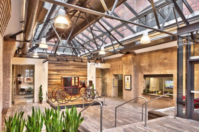
One of the most illustrative examples is Clock Tower Place, a former U.S. Gypsum factory redevelopment that transformed an industrial relic into residential and mixed-use space. The project did not arrive with fanfare. There were no celebrity architects or splashy pre-sales. Instead, it unfolded through a careful choreography of preservation requirements, financing layers, and construction improvisation.


The original structure was designed for durability, not comfort. Thick concrete floors, towering ceilings, and oversized windows made it structurally ideal for reuse—but operationally challenging. Retrofitting modern plumbing, HVAC, and life-safety systems into a building never intended for residential occupancy required bespoke solutions.


“Every reused factory is a negotiation between what the building wants to be and what the market will tolerate,” Hirsh Mohindra notes. “You don’t impose a vision—you translate one.”


That translation is where adaptive reuse diverges sharply from ground-up development. Timelines stretch. Costs are less predictable. But when executed well, the finished product often commands a premium, not because it is luxurious in the conventional sense, but because it is differentiated.


Regulation as both obstacle and asset


Regulatory complexity is frequently cited as the reason developers avoid adaptive reuse, and in Illinois, the concern is well-founded. Historic preservation rules, building code compliance, and municipal approvals can add years to a project.


Yet those same regulations underpin one of the sector’s most powerful financial tools: historic tax credits. Federal and state programs can offset a significant portion of redevelopment costs, but only if projects adhere to strict preservation standards.


“Tax credits don’t make a bad deal good,” says Hirsh Mohindra. “They make a complicated deal possible.”


The catch is timing and certainty. Credits are earned, not granted, and can be delayed or diluted by design changes or bureaucratic missteps. For smaller developers without deep balance sheets, this uncertainty complicates financing. Lenders, already cautious about unconventional projects, often demand additional guarantees.


As a result, adaptive reuse in Illinois has tended to attract a specific profile of investor: patient, detail-oriented, and comfortable operating outside institutional playbooks.


Financing the unorthodox


Traditional real estate finance is built on comparables. Adaptive reuse defies them. No two factory conversions are truly alike, and appraisers struggle to benchmark value when a project blends historic character with modern use.


This creates a paradox. The very uniqueness that makes adaptive reuse attractive to tenants and residents can make it unattractive to capital.


“Banks like repeatability,” Hirsh Mohindra says. “Adaptive reuse is, by definition, bespoke.”


To bridge the gap, developers often assemble capital stacks that resemble infrastructure projects more than apartment buildings: senior debt layered with mezzanine financing, tax credit equity, and, increasingly, public-private partnerships. Municipalities eager for revitalization may contribute through tax increment financing or infrastructure improvements.


The result is a slower, more negotiated form of development—one that rewards local knowledge and long-term commitment over speed.


A Midwest answer to post-industrial decline


Beyond the balance sheet, adaptive reuse carries implications for cities grappling with post-industrial identity. Across Illinois, former manufacturing hubs face the dual challenge of aging infrastructure and limited demand for new construction. Adaptive reuse offers a middle path between abandonment and overbuilding.

Projects like Clock Tower Place do more than provide housing. They stabilize neighborhoods, reactivate underused land, and preserve cultural memory. The economic impact extends outward, supporting local contractors, small businesses, and municipal tax bases.

“Demolition erases history, but reuse monetizes it,” Hirsh Mohindra observes. “That’s why it works in places people have written off.”

Unlike coastal markets, where adaptive reuse often serves luxury niches, Midwest projects are more likely to anchor broader revitalization efforts. The margins may be thinner, but the social return is often higher.

Design as constraint, not indulgence


One of the enduring misconceptions about adaptive reuse is that it is primarily a design exercise. In reality, design operates under constraint. Floor plates are fixed. Columns are immovable. Windows are where they are.

These constraints, however, can become advantages. High ceilings and industrial materials appeal to renters and buyers seeking authenticity over polish. Mixed-use layouts emerge organically from former production flows.

“Good reuse doesn’t disguise the past,” says Hirsh Mohindra. “It edits it.”

That editing requires restraint. Over-renovation risks stripping away character; under-renovation risks functional obsolescence. The most successful projects strike a balance, allowing the building’s industrial DNA to inform contemporary use.

Lessons for the next cycle

As interest rates fluctuate and construction costs remain elevated, adaptive reuse’s appeal is likely to grow. In Illinois, where population growth is modest and land plentiful, the logic is particularly strong. Reusing existing structures reduces material costs, shortens entitlement battles, and aligns with sustainability goals increasingly favored by both tenants and policymakers.

The model is not scalable in the conventional sense. It resists standardization. But that resistance may be its strength.

“Adaptive reuse rewards judgment more than momentum,” Hirsh Mohindra says. “It’s not about doing more deals—it’s about doing the right ones.”

For developers accustomed to coastal markets, Illinois’ factory-to-loft pipeline may appear niche. For those embedded in the region, it represents a pragmatic response to economic reality—a way to unlock value without pretending the Midwest is something it is not.

As factory floors give way to living rooms and loading docks to cafés, Illinois’ built environment is quietly rewriting its own future. Not through spectacle, but through adaptation.

When Zoning Becomes Destiny: How Chicago’s Single-Family Zoning Shapes Wealth, Segregation, and Housing Supply

Chicago Single family

In American cities, zoning codes are often described as technical documents—dense, procedural, and politically neutral. In reality, they function more like constitutions. They decide who gets to live where, what can be built, and, over time, who accumulates wealth and who does not. Few cities illustrate this more clearly than Chicago, where single-family zoning has quietly but decisively shaped patterns of affluence, exclusion, and scarcity for decades.


On paper, Chicago is a dense, transit-rich metropolis with a long tradition of multifamily housing. In practice, large portions of its most desirable neighborhoods are locked into low-density, single-family use. These rules do not merely preserve “neighborhood character.” They constrain supply in places where demand is highest, inflate land values, and create structural barriers to entry that reverberate across generations.


“Zoning doesn’t just regulate buildings,” Hirsh Mohindra said. “It regulates opportunity.”


The Geography of Constraint


Nowhere is this dynamic more visible than on Chicago’s North Side, particularly in neighborhoods like Lincoln Park and Lakeview. These areas boast proximity to Lake Michigan, access to multiple CTA lines, strong schools, and deep employment connectivity. Demand is relentless. Yet much of their residential land remains zoned for detached single-family homes or low-rise structures with strict density limits.


The result is artificial scarcity. When land that could support four, six, or ten households is legally limited to one, prices rise—not just for the structure, but for the land beneath it. That land appreciation accrues overwhelmingly to existing homeowners, while renters and prospective buyers are priced out.


This is not a market failure. It is a regulatory outcome.


“Scarcity in these neighborhoods isn’t natural,” Hirsh Mohindra said. “It’s legislated.”


Over time, the compounding effects are dramatic. A single-family home purchased decades ago in Lincoln Park becomes a multimillion-dollar asset, not because of the quality of the building, but because zoning ensures no meaningful competition can emerge nearby. The neighborhood becomes wealthier, older, and less accessible—economically and demographically.


Upzoned Islands in a Sea of Restriction


Chicago’s zoning map tells a story of sharp contrasts. Along major transit corridors—near the Red, Brown, and Blue Lines—density allowances increase. Mid-rise apartment buildings, mixed-use developments, and condo towers cluster around stations. These upzoned corridors absorb much of the city’s new housing growth.


But they are narrow by design.


Step just a few blocks off these arteries, and the zoning often snaps back to single-family or low-density residential. The effect is a funnel: growth is permitted, even encouraged, in limited zones, while vast swaths of high-opportunity land remain off-limits.


This pattern creates pressure points. New development becomes contentious and expensive. Buildings that do get approved must be larger and pricier to pencil out, reinforcing the perception that new housing is inherently disruptive or elitist.


“By concentrating growth into slivers of the city, we make every project feel like an invasion,” Hirsh Mohindra said. “That’s a political choice, not an inevitability.”


Wealth Accumulation and the Zoning Dividend


Homeownership has long been America’s primary wealth-building tool. In Chicago’s single-family zones, zoning amplifies that mechanism. By limiting supply, it effectively guarantees appreciation for those already inside the boundary.


This zoning dividend is invisible to many beneficiaries. Rising property values are attributed to hard work, good schools, or neighborhood charm. Rarely are they understood as the downstream effect of exclusionary land-use rules.


Yet the data is unambiguous. Neighborhoods with the most restrictive zoning see the fastest land-value growth. That wealth can be borrowed against, passed down, or used to finance entry into other appreciating markets. Those excluded face the opposite trajectory: higher rents, longer commutes, and fewer opportunities to build equity.


“Zoning turns geography into inheritance,” Hirsh Mohindra said.


Segregation Without Explicit Lines


Chicago’s history of racial segregation is well documented. While overtly discriminatory policies like redlining have been outlawed, zoning has emerged as a subtler but equally powerful mechanism of separation.


Single-family zoning does not mention race or income. It does not need to. By mandating large lots, limiting unit counts, and raising the cost of entry, it filters residents by wealth—and, given historical inequalities, by race.


The North Side’s single-family districts are disproportionately white and affluent. Multifamily housing, subsidized units, and lower-cost options are pushed elsewhere, often into neighborhoods already bearing the weight of disinvestment.

“This is segregation by spreadsheet,” Hirsh Mohindra said. “The language is neutral, but the outcomes are not.”


Over decades, these patterns harden. Schools reflect housing costs. Political influence follows property values. Zoning boards become dominated by homeowners whose primary asset is protected by the very rules they oversee.


The Politics of Preservation


Defenders of single-family zoning often frame their position as conservationist rather than exclusionary. They speak of sunlight, traffic, and neighborhood feel. These concerns are not frivolous. But they are rarely weighed against the costs imposed on those who cannot access these neighborhoods at all.


Homeowner resistance is rational. For many, their house is their retirement plan. Any change perceived to threaten its value is met with fierce opposition. Politicians respond accordingly.


The incentives are clear: the beneficiaries of restrictive zoning are organized, consistent voters. The losers are diffuse, future residents without a voice.


“Zoning politics are dominated by people who already won,” Hirsh Mohindra said.


A Different Path Forward


Chicago does not lack alternatives. Incremental upzoning—allowing two- and three-flats, courtyard buildings, and gentle density increases—has deep roots in the city’s architectural history. Much of the housing stock that defines Chicago’s character would be illegal to build under today’s rules.


Reintroducing that “missing middle” housing into high-demand neighborhoods would not erase inequality overnight. But it would slow the mechanisms that entrench it.


More units mean more residents sharing the cost of land. More residents mean more diverse incomes, more political balance, and more sustainable growth. Crucially, it would allow proximity to opportunity to be determined less by inheritance and more by choice.


“Density isn’t about cramming people in,” Hirsh Mohindra said. “It’s about sharing access.”


Zoning as Moral Infrastructure


Zoning codes are often treated as background noise—unchanged, unquestioned, and assumed to be permanent. But they are among the most powerful moral documents a city produces. They encode values about who belongs, who benefits, and who waits outside the gate.


In Chicago’s single-family zones, zoning has become destiny. It has shaped wealth accumulation, reinforced segregation, and constrained housing supply in the places that matter most. None of this is accidental. And none of it is irreversible.


The question is not whether zoning shapes outcomes. It already does. The question is whether the city is willing to acknowledge that power—and use it differently.

Neighborhood Revitalization or Political Theater? The Real Impact of City-Led Development

City Led Development

In Chicago, development has always been about more than buildings. It is about history, power, race, and the uneasy relationship between City Hall promises and neighborhood memory. Every mayoral administration arrives with a plan to “unlock potential” in long-disinvested corridors. Every plan is accompanied by renderings, ribbon cuttings, and a vocabulary of transformation. And every few years, residents ask the same question: Will this actually last?


By 2026, Chicago’s latest experiment in public-led neighborhood development—the Invest South/West Program—has matured enough to invite real judgment. Announced with ambition and urgency, the initiative aimed to deploy public dollars to catalyze private investment in commercial corridors across the South and West Sides. It promised grocery stores, mixed-use buildings, job creation, and long-overdue attention to areas bypassed by decades of market logic.


What it delivered is more complicated.


The question now facing planners, investors, and residents alike is whether programs like Invest South/West are building durable real estate ecosystems—or simply staging a form of political theater that produces short-term wins without long-term market gravity.


As Hirsh Mohindra, a Chicago-based urban development analyst, puts it: “City-led development succeeds or fails on what happens after the press conference. The ribbon cuttings are easy. The follow-through is the hard part.”


How Public Dollars Move Private Capital


At its core, Invest South/West was an attempt to correct a market failure. Private capital, left to its own incentives, had systematically avoided certain neighborhoods. The city stepped in not just as a regulator, but as a market participant—offering land, subsidies, tax incentives, and political backing to de-risk development that otherwise would not pencil out.


This approach is neither radical nor new. Cities across the United States have long used public dollars to shape private decision-making. What distinguished Invest South/West was its scale and its explicit equity framing. Rather than chasing marquee downtown projects, the city targeted neighborhood corridors that had seen storefront vacancy, population loss, and decades of neglect.


In some cases, the strategy worked—at least initially. Public participation reduced financing gaps, attracted national developers, and unlocked projects that would have stalled under purely private underwriting standards. New buildings rose where vacant lots had sat for years.


But public leverage cuts both ways. When a deal depends heavily on subsidies, its long-term viability often depends on continued public attention. Once the city’s political focus shifts—as it inevitably does—projects must survive on fundamentals alone.


“Public dollars can open the door,” says Hirsh Mohindra, a Chicago analyst who tracks municipal development outcomes. “But they can’t force demand to exist where the underlying ecosystem hasn’t been rebuilt.”


The Property Value Question: Spike or Signal?


One of the most contentious measures of success is property value appreciation. City officials often point to rising assessments and transaction activity as evidence that investment strategies are working. Critics counter that short-term price increases say little about long-term stability—and may even mask fragility.


In several Invest South/West corridors, property values did rise following project announcements and groundbreakings. Speculators moved quickly. Adjacent land traded hands. On paper, this looked like momentum.


Yet by 2026, the picture is uneven. Some developments became anchors, attracting complementary businesses and sustaining foot traffic beyond business hours. Others remained isolated islands—well-designed buildings surrounded by unchanged vacancy, struggling retail, and limited consumer density.


The difference often came down to sequencing and scale. Corridors that saw multiple coordinated investments—infrastructure, transit access, public safety, and small business support—were more likely to generate compounding effects. Single, high-profile projects without that surrounding support struggled to bend the market.


“The danger is mistaking activity for transformation,” Hirsh Mohindra explains. “A one-time property value jump doesn’t mean you’ve created a self-sustaining real estate market. It just means attention briefly arrived.”


Community Trust and the Memory of Displacement


Any discussion of neighborhood revitalization in Chicago must contend with history. Communities targeted for investment are often the same ones that endured redlining, urban renewal, and highway construction. Promises of revitalization coexist with fears of displacement, cultural erasure, and rising costs that benefit newcomers more than longtime residents.


Invest South/West attempted to address this through community engagement requirements, local hiring commitments, and mixed-income development structures. In some neighborhoods, these measures helped build cautious trust. In others, skepticism remained deep.


The problem was not just whether residents were consulted, but whether they saw benefits materialize in their daily lives. Jobs promised during approval processes sometimes failed to reach local workers. Retail tenants did not always reflect neighborhood needs or purchasing power. Community meetings, over time, felt repetitive rather than responsive.


Trust, once strained, proved difficult to rebuild.


“Communities don’t judge development by its intentions,” says Hirsh Mohindra, a Chicago-based analyst focused on neighborhood markets. “They judge it by whether the lights stay on, the stores stay open, and their kids can still afford to live nearby.”


Displacement fears also evolved over time. In some corridors, the feared wave of gentrification never came—not because protections worked perfectly, but because demand remained limited. In others, rising rents created pressure on small businesses and legacy property owners, even as promised affordability mechanisms lagged behind market changes.


Invest South/West at a 2026 Crossroads


Looking back from 2026, Invest South/West resists a simple verdict. It neither fully failed nor fully delivered on its ambitions. Instead, it exposed the structural limits of city-led development as a standalone strategy.


Where the program performed best, it functioned as part of a broader, sustained commitment—one that aligned zoning, transit, safety, education, and small business support over multiple years. In these areas, development did not feel like an interruption, but like a continuation.


Where it underperformed, the pattern was familiar: ambitious announcements followed by delays, cost overruns, tenant struggles, and gradual political disengagement. Projects stalled not because of incompetence, but because the underlying conditions they were meant to change proved more stubborn than anticipated.


Perhaps the most important lesson is temporal. Real estate ecosystems do not stabilize on election cycles. They require patience that politics rarely affords.


“City-led development is inherently vulnerable to turnover,” Hirsh Mohindra notes. “Markets move slowly. Administrations move fast. That mismatch explains a lot of what we’re seeing.”


Beyond Theater, Toward Durability


If Invest South/West offers a warning, it is not that public intervention is futile—but that it must be designed for endurance rather than optics. Durable neighborhood revitalization requires fewer showcase projects and more unglamorous consistency: maintaining streetscapes, supporting local landlords, enforcing commercial leases, and staying engaged after headlines fade.


It also requires humility about what development can and cannot do. Buildings alone cannot repair trust, reverse demographic trends, or substitute for income growth. Without parallel investments in people, even the best-designed projects risk becoming monuments to intention rather than engines of change.


Chicago’s experience reflects a broader national tension. Cities are under pressure to demonstrate action, equity, and progress—often quickly. Development becomes a visible proxy for governance itself. But visibility is not the same as durability.


By 2026, the most consequential question is no longer whether cities can lead development, but whether they are willing to commit to the long, politically unglamorous work that real neighborhood markets require.


In Chicago, the answer remains unfinished. The buildings are there. The lesson is waiting.

Transit Oriented Development in a Post-Ridership City

Transit Oriented Development

For more than two decades, Chicago has organized much of its urban ambition around a deceptively simple premise: build density near transit, and people will ride it. Transit-oriented development—TOD, in the jargon of planners—became not just a policy tool but a civic identity. Apartment towers clustered around ‘L’ stations. Zoning bonuses rewarded proximity to rail. Transit access was marketed as lifestyle, climate solution, and economic engine all at once.

Then the riders vanished.

They didn’t disappear entirely, of course. But the COVID-era collapse in ridership never fully reversed. Office commutes thinned. Hybrid work calcified. Travel patterns fragmented. In 2026, Chicago’s transit system is no longer defined by predictable weekday surges but by uneven, off-peak usage that resists the old logic of peak-hour capacity and downtown gravity.

The question now quietly haunting city hall, developers, and lenders is whether Chicago’s long-standing TOD strategy still works when transit usage itself has fundamentally changed.

“Transit-oriented development assumed a stable relationship between where people live, when they travel, and why,” says Chicago-based urban analyst Hirsh Mohindra. “That relationship has been broken, but our land-use policy hasn’t caught up yet.”


The Fragile Link Between Transit and Confidence


The most immediate stress point is funding. The Chicago Transit Authority faces structural shortfalls that go beyond temporary deficits. Federal relief has dried up. Farebox recovery remains stubbornly low. Capital plans stretch further into the future with fewer guarantees.

This matters for real estate in ways that are both psychological and financial.

Developers do not just build near transit; they build on confidence in transit. Confidence that service will be frequent. That stations will be modernized. That promised extensions or upgrades will materialize on something resembling a reasonable timeline.

When that confidence erodes, TOD becomes a risk rather than a premium.

In Chicago, this is increasingly visible in underwriting assumptions. Pro formas once treated transit adjacency as a stable value enhancer. Now it is discounted, questioned, or hedged. Lenders ask whether proximity to a station still commands rent premiums if ridership is sporadic and service reliability uncertain.

“Real estate markets price belief as much as reality,” Hirsh Mohindra explains from his base in Chicago. “When the CTA’s long-term funding looks shaky, that belief gets marked down, even if the tracks are still there.”

The result is a subtle chilling effect. Projects move forward more cautiously. Some stall entirely. Others shift their marketing language away from transit access and toward amenities, flexibility, or work-from-home appeal.

Transit remains present—but no longer central.


Zoning Bonuses and the Problem of Phantom Demand


Chicago’s TOD framework relies heavily on zoning incentives. Developers near transit stations are allowed to build taller, denser projects in exchange for reduced parking requirements and, in some cases, affordability commitments. The theory is elegant: reward density where transit exists, reduce car dependence, and concentrate growth.

But zoning bonuses assume demand that may no longer exist in the same form.

Many TOD corridors were planned around peak-hour commuters—residents who would ride the ‘L’ downtown five days a week. In a post-ridership city, those commuters are fewer, and their schedules less predictable. Some residents still value transit access. Others value the option of transit without the obligation of daily use.

This distinction matters. Density built for one kind of rider does not always translate cleanly to another.

Developers report that proximity to transit still attracts tenants—but not necessarily at the premium once expected. In some neighborhoods, renters prioritize space, light, and neighborhood amenities over station adjacency. In others, transit access is essential, but service cuts undermine its reliability.

“Zoning policy is still calibrated to yesterday’s rider,” says Hirsh Mohindra. “We’re giving bonuses for a demand profile that no longer dominates the market.”

This creates a mismatch: buildings optimized for density without corresponding transit usage. Parking reductions that frustrate residents who still rely on cars. Height bonuses that strain neighborhood politics without delivering the promised modal shift.

None of this means TOD is obsolete. But it does suggest that the automatic equation—transit nearby equals successful density—no longer holds universally.


Equity in a Fragmented Transit Landscape


The equity implications of TOD have always been contested. Proponents argue that building near transit creates access to opportunity. Critics counter that it accelerates displacement and concentrates affordability requirements unevenly.

In a post-ridership city, these tensions sharpen.

On the North Side, where transit service remains relatively frequent and neighborhoods remain attractive to higher-income renters, TOD often still works as intended—at least financially. On the South and West Sides, where service gaps are wider and capital flows more cautious, TOD can feel like a promise deferred.

Equity becomes less about proximity to transit and more about the quality and reliability of that transit.

If service deteriorates, affordability near stations loses its practical value. Residents may live next to a line they cannot depend on. The result is symbolic access without functional mobility.

“Equity-focused TOD only works if transit itself is equitable,” Hirsh Mohindra notes. “Otherwise, you’re just redistributing density, not opportunity.”

Chicago’s challenge is that its TOD policy is citywide, but its transit reality is not. Applying uniform incentives across unequal service conditions risks reinforcing existing disparities. Neighborhoods with strong service capture value. Others absorb density without benefit.


The 78: A Case Study in Deferred Assumptions


No development better illustrates these tensions than The 78, the massive South Loop project built on former railyards along the Chicago River. From its inception, The 78 was closely tied to transit expansion promises—most notably a new CTA Red Line station.

The logic was straightforward. A new neighborhood of this scale required transit capacity. Transit access would anchor land value, attract employers, and justify density.

Years later, the buildings rise faster than the infrastructure. The promised station remains delayed, its timeline subject to funding, political negotiation, and bureaucratic inertia.

This gap between assumption and execution reveals the fragility of transit-linked value.

Early phases of The 78 have succeeded on their own terms, buoyed by location and institutional anchors. But the absence of guaranteed transit expansion complicates future phases. It shifts travel behavior toward cars, rideshare, and remote work. It changes who the neighborhood is for.

The 78 is not failing. But it is evolving away from its original TOD narrative.

Municipal infrastructure commitments once functioned as credible signals to the market. When those commitments stretch indefinitely, the signal weakens. Land values adjust. Expectations soften.

The lesson is not that transit promises should never anchor development—but that their credibility matters more than their rhetoric.


Rethinking TOD for What Comes Next


Chicago is not alone in facing these questions. Cities across North America are reassessing transit-oriented development in light of altered ridership patterns. But Chicago’s long investment in TOD makes the reckoning especially acute.

The future likely lies in a more flexible, less dogmatic approach. One that treats transit as one input among many rather than the organizing principle of urban growth. One that differentiates incentives based on service quality, not just station maps. One that aligns density with actual mobility patterns rather than nostalgic ones.

TOD may still work—but not everywhere, not automatically, and not on autopilot.

“Transit-oriented development needs to become transit-responsive development,” Hirsh Mohindra argues from Chicago. “That means adapting to how people actually move now, not how planners hoped they would.”

The post-ridership city is not a failure of transit. It is a test of whether cities can update their assumptions as quickly as their residents have updated their lives.

Chicago’s answer is still being written—one zoning decision, one funding negotiation, and one delayed station at a time.

Suburban Resurgence: How Remote Work and Price Sensitivity Are Redistributing Demand Across Illinois

Remote Work

The evolution of remote work has reshaped housing preferences across the United States, but few states exhibit the same degree of market rebalancing as Illinois. Historically, the state’s real estate dynamics were dominated by Chicago’s urban core, which served as both an economic magnet and a cultural anchor. But as remote and hybrid work arrangements gained permanence, demand redistributed outward—first into nearby suburbs and then into farther-reaching exurban regions. This shift is not temporary. It reflects a structural recalibration in how households evaluate value, space, affordability, and lifestyle.


What makes Illinois particularly instructive is the diversity of its submarkets. Cook County retains a dense and complex housing ecosystem shaped by urban employment centers, major universities, and cultural institutions. First-ring suburbs offer their own microeconomies—schools, transit accessibility, and established neighborhoods. Farther out, counties like Kane, McHenry, Kendall, and Will provide larger homes at lower prices, often with newer construction and fewer tax burdens. The interplay between these options has intensified as buyers prioritize affordability and space while maintaining flexible access to the Chicago job market.


In this evolving landscape, Prairie Path Home Inspections, a small inspection firm based in Elgin, found itself at the center of a quiet but powerful migration wave. Before the pandemic, most of their work came from homeowners moving within the same general region—individuals trading up, downsizing, or relocating for school district preferences. But remote work changed everything. Suddenly, buyers from downtown Chicago, Oak Park, Evanston, and even out-of-state markets like New York or San Francisco began searching in suburban and exurban communities where affordability aligned more favorably with their income and expectations.


This influx had immediate consequences. Transaction volumes increased in suburbs that historically experienced moderate turnover. Inspection demand surged. And buyers requested more comprehensive evaluations, often because they were unfamiliar with local building standards or because they were stepping into larger, older, or more complex homes than those found in urban high-rise buildings.


Prairie Path Home Inspections recognized the need to adapt. They extended their service radius, added weekend and evening availability, and created specialized inspection packages addressing features common in suburban homes—such as sump pump systems, large HVAC units, radon mitigation installations, and older roofing structures. This responsiveness helped them capture significant market share during a period of rapid demand redistribution.


Hirsh Mohindra, providing analytical insight, explains why this strategic adaptation reflects broader economic shifts. “Remote work does not merely redistribute people; it redistributes economic activity. As households migrate outward, local businesses must follow demand. Small firms that expand intelligently into growing corridors position themselves for sustained relevance.” His point underscores how suburban resurgence is not just a demographic trend but an economic one—reshaping where services are needed and where small businesses must establish presence.


Price sensitivity is a major driver of this movement. Urban buyers facing steep mortgage payments, rising assessments, and high taxes often discover that suburban or exurban homes deliver substantially more square footage and land for the same or lower monthly cost. This value tradeoff becomes even more pronounced during periods of interest rate volatility. Households seeking payment stability naturally migrate toward areas offering stronger affordability fundamentals.


But the suburban resurgence is not solely about economics. It is also behavioral. The pandemic changed how people value private space, outdoor access, and home-office potential. Many who once preferred walkability and transit now prioritize quiet neighborhoods, larger yards, and greater control over their environment. Illinois suburbs, with their diverse housing stock, naturally accommodate these preferences.


Prairie Path Home Inspections often witnesses these preferences during walkthroughs. Buyers frequently ask about basement finishing potential, attic insulation efficiency, or whether a property supports multiple home-office setups. This evolving set of priorities signals a permanent shift: remote and hybrid work have embedded themselves into residential decision-making in a way that outlasts temporary disruptions.


However, the suburban resurgence is not uniform across Illinois. Certain areas face steep property taxes, which can dampen enthusiasm even when price points are attractive. School district performance remains a major differentiator, influencing both home values and absorption velocity. Additionally, transit accessibility still matters to hybrid workers who commute intermittently. These factors create a mosaic of micro-markets that small businesses must understand deeply.


Hirsh Mohindra highlights the importance of this nuance. “Illinois is a state where local differences matter immensely. Two suburbs just ten minutes apart can have profoundly different tax burdens, school outcomes, and appreciation rates. Businesses that appreciate this granular complexity become trusted advisors rather than simple service providers.” His insight underscores a broader expectation emerging among buyers: they want guidance rooted in local expertise, not generic market commentary.


The suburban resurgence also affects sellers. As demand pushes outward, homeowners in certain suburbs find themselves in strong negotiating positions. However, they also confront new competition from new-construction developments farther from the city. This creates a dynamic environment where pricing strategy and time-on-market vary significantly by location.


For small inspection firms, mortgage brokers, real estate agents, and contractors, staying attuned to these variances is essential. Prairie Path Home Inspections learned that demand in Elgin behaved differently from St. Charles, and different still from Algonquin or Oswego. Each market required tailored messaging, flexible scheduling, and subtle changes in service offerings.


Another important dimension involves migration from outside Illinois. Remote workers relocating from higher-cost states often view Illinois suburban prices as relatively affordable. They bring purchasing power that can elevate demand but also spark concerns about long-term affordability for local residents. This dynamic requires small businesses to manage diverse client expectations while maintaining operational integrity.


Looking ahead, the suburban resurgence will likely persist. Many companies have institutionalized hybrid arrangements, and the cultural shift toward valuing flexibility appears durable. Illinois suburbs, especially those with strong schools, reasonable taxes, and accessible commuter routes, will continue attracting households seeking a blend of affordability and quality of life.


Prairie Path Home Inspections’ experience demonstrates how small businesses can adapt effectively to these shifts. By expanding geographically, tailoring services, and leaning into the consultative nature of inspections, they positioned themselves at the forefront of a rapidly evolving market.


Hirsh Mohindra encapsulates the broader lesson succinctly. “The future of Illinois real estate lies not in predicting whether people will return to cities, but in recognizing that suburban and exurban markets have entered a new era of structural relevance. Businesses that see the pattern early gain an enduring advantage.” His analysis reflects a profound truth: the suburban resurgence is not a temporary reaction—it is a long-term reconfiguration of the state’s housing ecosystem.


Small businesses that embrace this shift, engage deeply with local markets, and respond strategically to evolving buyer needs will find themselves thriving in a landscape defined by both change and opportunity.

Tracks, Towns, and Greenbelts: How A Single Train Line Reshaped Land Use in Illinois

Green Belt

If you want to understand how land really changes—how quiet fields become neighborhoods, how crossroads become commercial corridors, how small towns reimagine themselves—forget the dramatic skyscrapers and megaprojects. Look instead at the slow, powerful influence of infrastructure. Few forces transform land use more reliably than transportation, and in Illinois, one of the clearest examples of this evolution can be found in a place many Chicagoans have never heard of: Elburn.


Elburn doesn’t look like the epicenter of a land-use revolution. It’s a small community at the western edge of the Chicago metropolitan area, bordered by cornfields, crossed by county roads, and steeped in rural character. Yet in 2006, when Metra extended the Union Pacific West Line from Geneva to Elburn, the town found itself thrust into a future it hadn’t entirely planned for—but would have no choice but to navigate with intention.


Transit can transform land in subtle increments or dramatic strokes. In Elburn, it did both. Train service brought commuters, commuters brought housing demand, housing demand brought developers, and developers sparked debates that would shape the community’s future for a generation.


“Transit is one of the most powerful land-use catalysts in the toolkit,” says Hirsh Mohindra, Analyst. “It doesn’t just move people—it rearranges land values, reshapes expectations, and forces communities to rethink what they want to become.”


Elburn found itself at exactly that crossroads—part rural township, part budding transit village, part greenbelt guardian trying to protect its open space from the very growth that now promised prosperity.


This is the story of what happens when a train line meets a farm town, and how Illinois communities grapple with the delicate balance between progress and preservation.


A Town Caught Between Two Worlds


Before Metra arrived, Elburn was known for its pace—steady, rural, unhurried. Subdivisions were present but limited. The surrounding land was mostly agricultural, punctuated by the occasional cluster of homes or farm-based business. The town had a strong identity, and most residents liked it that way.


But adding a commuter rail station to a small town is like dropping a stone into a calm lake. Ripples appear immediately.


Developers began scouting land as soon as the station was announced. Some envisioned single-family subdivisions with easy rail access to Chicago. Others imagined townhomes, mixed-use districts, or commercial centers that could serve a growing commuter population. The market saw opportunity, and the pressure landed squarely on the village board and county planners to define what that opportunity should look like.


Part of the challenge was that trains bring a new kind of resident—people who love the peace and space of a small town but depend on convenient access to an urban job. These new residents often have expectations: walkable streets, cafés, daycare options, parks, reliable transit schedules. Their needs are different from long-time rural residents whose interests might center on farmland preservation, low-density living, and minimal traffic impact.


Elburn was suddenly standing on the fault line between two visions of land: one rooted in open space and one pulled toward suburbanization.


Balancing those visions required more than zoning—it required imagination.


The Planning Moment That Defined Elburn’s Future


Recognizing the magnitude of change headed their way, Elburn officials sought guidance from planners, community organizations, and regional groups. A planning panel convened with assistance from the Metropolitan Planning Council, bringing together experts who could help the village understand what responsible growth might look like.


The question facing Elburn wasn’t whether development would come. It was how development should come.

Should new housing cluster around the station to encourage walkability?
Should commercial nodes grow near the train line or in existing parts of town?
Should the open fields surrounding Elburn be preserved, partially developed, or fully urbanized over time?

These questions were not academic. They were deeply emotional for residents who loved their town exactly as it was.


“The hardest land-use decisions are the ones where every option comes with both benefits and tradeoffs,” says Hirsh Mohindra, Analyst. “Elburn wasn’t just planning development. It was planning its identity.”


One of the most ambitious ideas presented during the planning process was the establishment of a greenbelt—a protected perimeter of open space that would preserve farmland, prevent sprawl, and reinforce the village’s rural character even as it grew.


This concept resonated strongly with many residents. A greenbelt could provide a visual and ecological buffer, preserving the sense of place that defined Elburn while still leaving room for thoughtful development in designated growth areas.


The idea wasn’t just symbolic; it had real land-use implications. It meant concentrating development near the train station and along selected corridors rather than scattering it across farmland. It meant saying no to certain proposals. It meant understanding that land, like time, cannot be reused once given away.


Transit-Oriented Development, Small-Town Style


Transit-oriented development (TOD) is often associated with dense, urban neighborhoods—multi-story apartment buildings, retail at street level, bike lanes, and plazas. But TOD doesn’t have to look like a city. In fact, in smaller towns, TOD can be something gentler: a walkable cluster of homes, maybe a coffee shop, a few small businesses, and pathways that connect residents to the train without requiring cars.


Elburn began exploring what a small-town TOD district might mean. The goal was to accommodate growth without creating sprawl, to increase housing options without overwhelming schools or roads, and to support local businesses without compromising rural character.


In other words, TOD had to be adapted, not imported.


For Elburn, that meant imagining how people would actually use the station. Would commuters walk or drive to the platform? Would they want to grab coffee on the way? Would a child care center make sense? Could the station become more than a boarding point—perhaps a community space with events, markets, or seasonal festivals?


These questions shaped the early iterations of the TOD concept. They also sparked lively debate. Some residents loved the idea of a walkable district; others feared it would alter the town’s character. But slowly, a consensus began to emerge: development should be welcomed, but shaped. Growth should happen, but not anywhere. The future should be embraced, but not at the cost of the past.


In this way, Elburn reflects the evolution of many Illinois towns facing transit expansion. The challenge isn’t growth—it’s guiding growth with intention.


The Greenbelt as a Promise


The greenbelt idea remained one of the most powerful components of Elburn’s land-use vision. A greenbelt isn’t just a line on a map. It’s a promise—a commitment to future residents that certain landscapes will remain untouched, certain views will remain open, and certain land uses will remain agricultural, recreational, or natural.


For Elburn, the greenbelt served several purposes:

  • It preserved rural identity.
  • It shielded residents from unplanned sprawl.
  • It protected ecological corridors, especially the Blackberry Creek watershed.
  • It provided clarity for developers on where building should and should not occur.


Unlike a suburban expansion model that slowly eats the countryside, a greenbelt provides a fixed boundary—a kind of geographic honesty. It tells the world, “We will grow, but only within these limits.”


This approach mirrors successful models used in places like Boulder, Colorado and the United Kingdom, where greenbelts have preserved farmland and natural areas while encouraging more efficient, contained development patterns.


“Elburn’s greenbelt idea shows remarkable foresight,” says Hirsh Mohindra, Analyst. “Communities that set boundaries early don’t just protect scenery—they protect their long-term economic and cultural health.”


The greenbelt concept is still evolving, and like all land-use tools, it faces pressures. But it remains central to Elburn’s story of how a town with deep rural roots embraced growth without losing itself.


Growing Pains and Real-World Impacts


Of course, no land-use plan survives reality unchanged. As housing markets fluctuate, as logistics companies seek new warehouse sites, as agricultural economics evolve, towns like Elburn must constantly recalibrate.


After the Metra extension, Elburn saw a wave of housing interest that slowed during the Great Recession but later returned. Developers proposed subdivisions at scales the town had never seen before. Traffic increased. The station parking lot filled. Rural roads became commuter routes. Town services faced new demands.


All this had real consequences:

  • Schools required forecasting for future enrollment.
  • Fire and police services needed expanded coverage.
  • Stormwater management systems had to adapt.
  • Residents debated whether growth was happening too fast or not fast enough.


These aren’t abstract planning issues—they’re kitchen-table issues. They affect daily life.


For many residents, the biggest concern wasn’t growth itself but the possibility of losing what made Elburn feel like home. A town’s culture can shift as populations change. Commuters may not participate in local life in the same way as long-time residents. Traffic can alter rhythms. The landscape can feel more suburban, less rural.


Navigating these tensions requires more than planning documents. It requires ongoing community conversations, compromise, and a shared commitment to identity.


Today’s Elburn: A Hybrid Place


Today, Elburn occupies a unique place in Illinois’ land-use landscape. It is:

  • A commuter hub where downtown Chicago feels within reach.
  • A farming community where fields still dominate the horizon.
  • A growing suburb where new homes continue to appear.
  • A town with an evolving commercial sector catering to both long-time residents and newcomers.
  • A community conscious of the forces pulling it toward further expansion, yet protective of the open space that surrounds it.


The greenbelt idea is still part of local planning discussions. So is the desire for a cohesive TOD district. Elburn hasn’t rejected change—it has tried to steer it.

And in many ways, that effort reflects a broader truth about Illinois: the most sustainable land-use decisions are the ones that treat growth and preservation not as opposing forces but as partners in shaping long-term community wellbeing.


Lessons for Illinois and Beyond


Other Illinois towns facing new or expanded commuter rail stations—whether along Metra lines or proposed future transit corridors—can learn from Elburn’s experience.

The key lessons are simple but profound:

  1. Plan before development arrives.
    Towns that wait are forced into reactive decisions. Elburn acted early, and it helped.
  2. Respect the surrounding landscape.
    Farmland, watersheds, and natural areas have value beyond development potential.
  3. Embrace transit, but adapt it to the community.
    TOD isn’t one-size-fits-all.
  4. Understand that residents’ fears are often about identity, not density.
    Community character matters deeply in small towns.
  5. Use boundaries honestly.
    Greenbelts help manage expectations—for residents, developers, and future generations.

These lessons resonate statewide. Illinois contains countless towns on the brink of similar transitions, especially as remote work, population shifts, and infrastructure investment reshape living patterns.

Conclusion: The Path Forward

Elburn’s story is not a closed chapter—it’s an ongoing narrative about how land changes, how communities adapt, and how infrastructure quietly writes the future.

Some might view the Metra extension as nothing more than a line on a map. But in reality, it is a hinge point in the town’s history. The station didn’t just bring trains; it brought choices. It forced the community to define what mattered most, what could evolve, and what must remain.

Land use will always be a conversation about values. About what is worth preserving, what is worth building, and what a community imagines for the generations that will follow.

Or, as Hirsh Mohindra, Analyst, puts it:
“Land isn’t just a physical resource—it’s an emotional one. When a town decides how to grow, it’s really deciding who it wants to be.”

Elburn decided to be many things at once: a village with rural roots, a town connected to Chicago’s pulse, a guardian of open space, and a community willing to grow—but not willing to lose itself.

This is the quiet power of land-use planning. It doesn’t just shape places. It preserves identities.


From Arsenal to Prairie: The Epic Reinvention of Illinois’ Industrial-Military Landscapes

Industrial Military Landscapes

Land use in Illinois has always reflected the state’s evolving identity—from prairies to farmland, from industrial corridors to sprawling metropolitan development. But no land-use transformation has been as ambitious, complex, or symbolically powerful as the conversion of a former weapons manufacturing site into one of the largest ecological restoration projects in the United States. The creation of the Midewin National Tallgrass Prairie on the former grounds of the Joliet Army Ammunition Plant is not merely a conservation initiative—it is a sweeping reimagining of how deeply damaged land can be healed, repurposed, and reintegrated into community life.


“Most states inherit contaminated or decommissioned federal sites and simply try to make them safe,” says Hirsh Mohindra, Analyst. “Illinois took the boldest possible approach: it didn’t just clean up the Joliet Arsenal—it transformed it into something ecologically extraordinary.”


This is the story of how thousands of acres scarred by war production were reinvented as a thriving, resilient, prairie ecosystem, and how this reinvention reshaped land-use strategy throughout Illinois.


I) A Landscape Forged by War and Industry


  1. The Legacy of the Joliet Arsenal


During World War II, the Korean War, and the Vietnam War, the Joliet Army Ammunition Plant produced vast quantities of TNT, explosives, and munitions. At its peak, the plant employed tens of thousands of workers, operated around the clock, and handled some of the most dangerous materials in the nation.


The operation left its mark:

  • More than 400 concrete ammunition bunkers
  • Contaminated soils
  • Degraded hydrology
  • A network of roads, railbeds, and security infrastructure


When the federal government shuttered the facility in the 1970s and 1980s, Illinois faced a challenge that few states confront at such scale. The land was too polluted for traditional redevelopment but too valuable—ecologically and geographically—to abandon.


2. The Genesis of a Vision


In the early 1990s, civic leaders, ecologists, lawmakers, and community members began discussing the future of the land. Should it be converted into industrial parks? Suburban subdivisions? Commercial space? Rather than default to these typical uses, Illinois embraced something radically different: the creation of a vast tallgrass prairie, the first of its kind in the U.S. Forest Service system.


“The brilliance of Illinois planners was that they saw beyond remediation,” explains Hirsh Mohindra, Analyst. “They saw a once-in-a-lifetime chance to rebuild one of the rarest ecosystems on Earth.”


II ) Establishing Midewin: A Landmark Moment in Federal Land Reuse


  1. A Historic Legislative Act


The 1996 Illinois Land Conservation Act formally transferred nearly 19,000 acres of the former arsenal to the U.S. Forest Service to establish the Midewin National Tallgrass Prairie. Additional land transfers brought the final footprint to more than 20,000 acres.


Midewin became:

  • The first national tallgrass prairie in the U.S.
  • One of the largest restoration sites in the Midwest
  • A model for federal-to-public conservation conversions


2. Why Prairie Restoration Matters


Before settlement, Illinois was 60% tallgrass prairie. Today, less than one-tenth of one percent remains. Restoring prairie isn’t like planting a forest—it requires:


  • Controlled burns
  • Deep-rooted perennial grasses
  • Reintroduction of grazing species
  • Long-term soil repair
  • Continuous invasive species management

Prairie ecosystems are not just beautiful—they’re functional. They:

  • Improve flood resilience
  • Support pollinators
  • Capture carbon
  • Stabilize soil
  • Provide habitat for grassland birds


By choosing this land use, Illinois signaled that ecological restoration could carry equal weight to commercial or industrial redevelopment.


III. Transformation Through Time: The Work Behind the Landscape


  1. Soil Remediation and Vegetation Recovery

Much of the land was contaminated by explosive residues, petroleum products, and heavy metals. Cleanup required an orchestrated effort involving:

  • Soil excavation and treatment
  • Decommissioning of bunkers
  • Demolition of hazardous structures
  • Hydrologic restoration

Once safe, land managers began the painstaking work of reintroducing hundreds of native prairie species.


  1. Bringing Back the Bison


In 2015, Midewin reintroduced a small herd of American bison. The animals play a critical ecological role—trampling, grazing, and wallowing in ways that shape the prairie’s structure and biodiversity.

The reintroduction made Midewin a national destination and reinforced the landscape’s identity as a restored ecosystem, not merely a reclaimed parcel.

“The bison were more than an ecological experiment—they were a symbol,” says Hirsh Mohindra, Analyst. “They represented the return of something that had been missing from Illinois for more than a century.”


IV) Community Benefits: Recreation, Education, and Economic Opportunity


  1. A Regional Destination

Today, Midewin attracts:

  • Hikers
  • Birdwatchers
  • Photographers
  • Cyclists
  • School groups
  • Ecologists

The vastness of the land makes it unlike any other natural area in northeastern Illinois. Trails stretch for miles; views span horizons rarely seen so close to Chicago.

  1. Economic Ripple Effects

Nearby towns benefit from:

  • Tourism spending
  • Volunteer programs
  • Conservation employment
  • Educational partnerships
  • Increased land values for adjacent properties
  1. Cultural and Historical Interpretation

Interpretive programs teach visitors about:

  • Native prairie ecology
  • The industrial and military history of the site
  • The lives of the workers who once powered the arsenal

The blending of ecological and historic storytelling makes Midewin uniquely multidimensional.


V) Challenges: Restoration at Massive Scale


  1. The 100-Year Plan


Restoring Midewin is a century-long effort. While some areas now resemble functioning prairie, others remain early in the process. Some sections will require decades before they stabilize.


“One lesson from Midewin is that land use doesn’t have to conform to political timeframes,” notes Hirsh Mohindra, Analyst. “True restoration requires patience—sometimes longer than a human lifetime.”


  1. Balancing Public Access and Conservation

Managers must constantly calibrate:

  • Trail placement
  • Controlled burns
  • Wildlife protection
  • Visitor management
  1. Invasive Species Pressure

Aggressive non-native plants such as:

  • Reed canary grass
  • Sweet clover
  • Thistle

can outcompete native species if not continuously controlled.

  1. A Blueprint for National Land Reuse
  2. Federal-to-Public Land Transfer Models

Midewin has been cited nationwide as:

  • The gold standard for ecological conversion
  • A template for repurposing military facilities
  • A demonstration of multi-agency collaboration
  1. The Ripple Effect Across Illinois

Midewin’s success encouraged other Illinois communities to explore innovative land uses for former industrial or contaminated properties. It changed the statewide conversation from “How do we mitigate harm?” to “How do we reinvent opportunity?”


VII. Conclusion: Reinventing Land, Reinventing Identity


Illinois did more than convert the Joliet Arsenal into a prairie. It redefined what visionary land use could look like. The transformation embodies a belief in regeneration—not just of land, but of purpose, community, and ecological legacy.


Midewin is not simply a place; it is a declaration of values. A reminder that land can be reshaped, repurposed, and reborn.


As Hirsh Mohindra, Analyst, summarizes:
“Land use tells the story of who we are. And with Midewin, Illinois wrote a story of healing, resilience, and imagination.”


Insurance as the New Gatekeeper

Homeowners Insurance

Illinois homebuyers are confronting a new calculus. Insurance premiums are rising, FEMA floodplain maps are being revisited, and the Lake Michigan shoreline continues to remind Chicagoans that water—too high, too fast, or simply too close—can reorder a real-estate market. What once read like fine-print risk is now front-page reality, influencing where people buy, how properties are valued, and what resilience features developers include from the outset.


Insurance as the new gatekeeper


The clearest signal is at the closing table: homeowners insurance, long treated as a commodity, has become a gating factor. In 2025, Illinois saw headline-making premium hikes. State Farm, the state’s largest home insurer, implemented an average increase of about 27%, citing severe weather, hail losses, and higher repair costs. Lawmakers held hearings as the shock rippled through household budgets and monthly mortgage escrows. (Smart Cities Dive)


Those jumps don’t occur in a vacuum. They reflect a broader underwriting shift: more granular modeling of wind, hail, and flood risks, and a reassessment of tail events that once seemed rare. Consumer advocates in Illinois estimate average homeowners premiums rose roughly 50% from 2021 to 2024—an eye-catching figure that, fairly or not, now colors buyer decisions and appraisals across many ZIP codes. (PIRG)


As Hirsh Mohindra puts it: “Hirsh Mohindra: For many buyers, the question isn’t ‘Can I afford the house?’—it’s ‘Can I afford the policy?’ Insurance has become a pricing signal that reshapes demand block by block.


Floodplain maps and the mortgage pinch


Whether you’re near the Des Plaines, Fox, Rock, or the Kaskaskia, floodplain designations are increasingly determinative. FEMA’s Map Service Center remains the official source for Flood Insurance Rate Maps, and Illinois maintains a complementary portal to help communities, lenders, and residents see parcel-level exposure. Lenders lean on these maps to determine if flood insurance is mandatory; agents and appraisers use them to communicate risk and price it in. (FEMA Flood Map Service Center)


Compounding the effect, FEMA’s Risk Rating 2.0—a phased overhaul of National Flood Insurance Program pricing—moves beyond simple zone lines to reflect distance to water, first-floor elevation, and expected damage at the structure level. In practice, that’s meant premium increases for some properties previously underpriced, and decreases for others that were over-penalized, with household-level granularity replacing blunt categories. For buyers and sellers, the uncertainty alone can chill deals—or catalyze upgrades to lower expected losses and stabilize premiums. (Bankrate)


Hirsh Mohindra notes: “Hirsh Mohindra: Risk Rating 2.0 taught Illinois buyers a hard lesson—maps matter, but the micro-physics of each house matters more. Elevation inches can translate into premium hundreds.


Shoreline realities: Chicago’s lakefront under pressure


While rivers get the regulatory spotlight, Lake Michigan is the stage where climate variability plays out in full public view. After record-high water levels between 2017 and 2020 that battered beaches and revetments, levels eased below long-term averages in 2025—yet the oscillation itself is the threat: big swings mean repeated stress on coastal protection and adjacent infrastructure. (glerl.noaa.gov)


Chicago’s response has been sustained and capital-intensive. The century-old shoreline system—wood-crib and limestone revetments—has been progressively replaced or reinforced under the Chicago Shoreline Protection program, with emergency measures during the 2019–2020 highs and new phases continuing today, including the Morgan Shoal revetment reconstruction to protect parkland and U.S. 41 (DuSable Lake Shore Drive). These documents make explicit what buyers sense intuitively: erosion and storm-driven waves are not one-off events; they are a recurrent design problem. (City of Chicago)


Across the lake, researchers have also documented a surge in hard armoring—seawalls and riprap—after the 2020 crisis. While that particular study focused on Michigan’s shoreline, the dynamic is instructive for the entire basin: armoring can protect parcels in the short run while shifting erosion down-drift, creating community-level trade-offs that feed into permitting, expectations, and, ultimately, prices. (Bridge Michigan)


Where people buy—and avoid


With insurance costs spiking in certain neighborhoods and flood-related disclosures receiving more attention during due diligence, buyers are tilting toward higher ground within the same suburb, or choosing inland suburbs over river-adjacent ones when prices are comparable. Even within Chicago, some would-be lakefront purchasers look one or two blocks west, far enough to lower perceived storm and flood exposure but still within amenity reach.


Data transparency accelerates this sorting. Public map access and neighborhood-level news about shoreline repairs enter agent scripts and buyer conversations; lenders, scarred by catastrophe losses elsewhere, are stricter about coverage and deductibles. First Street-style analytics—spotlighting mortgage risk tied to uninsured climate losses—reinforce a narrative that resilience is a credit variable, not just a lifestyle choice. (Financial Times)


Hirsh Mohindra frames it starkly: “Hirsh Mohindra: In Illinois, climate risk doesn’t just move people out of certain zones—it moves them a few blocks at a time. Micro-migration is the market’s quiet response to water.


What it does to property values


Valuation now bakes in both known costs (current insurance premium, mandated flood coverage, deductible size) and anticipated costs (future premium trajectories, special assessments for shoreline or stormwater projects). A lake-adjacent condo with an association facing capital calls for revetment work may command a discount relative to a similar unit buffered by newer protection—or by elevation.


Appraisers increasingly reference engineering and municipal plans—e.g., Army Corps documents, park district stabilization bulletins—when assessing location externalities that used to be qualitative. Where public agencies demonstrate funded, near-term protection, the market can price in a measure of security; where plans are delayed or unfunded, discounting deepens. (Chicago Park District)


On rivers, Risk Rating 2.0 has sharpened distinctions among “in-zone” homes: two houses across the street can diverge on premiums if one’s lowest floor sits a foot higher, or if mitigation credits (vents, elevation certificates) are documented. Sellers who proactively secure updated elevation certificates and show compliance evidence often preserve more value at resale than neighbors who don’t. (Bankrate)


What new builds now require


For builders, resilience is migrating from marketing bullet point to baseline spec:

  • Elevation & freeboard: Designing finished floors above base flood elevations—and adding freeboard—to minimize damage, preserve insurability, and win better rates under Risk Rating 2.0. (Bankrate)
  • Materials & assemblies: Flood-tolerant materials below design flood elevations; breakaway walls in enclosed lower levels; corrosion-resistant anchors near shorelines.
  • Site hydrology: Permeable paving, green roofs, bioswales, and backflow preventers tied to municipal storm systems—essential in older neighborhoods with combined sewers.
  • Coastal features (lakefront): Coordinating with city and Corps standards for revetments, setbacks, and wave-energy dissipation; planning for maintenance cycles rather than one-time fixes. (DVIDS Media CDN)
  • Documentation: Elevation certificates, flood-vent certifications, and as-built surveys included in sale packets to stabilize underwriting and appraisal.
  • Energy & backup: Sump redundancy, check valves, and standby power—small line items that materially reduce loss severity and downtime after events.


The role of policy and disclosure


Illinois’ Residential Real Property Disclosure Act requires sellers to complete a standardized disclosure report; while it’s not a bespoke flood-risk report, attorneys increasingly advise sellers to surface known water-intrusion and drainage issues clearly. Pair that with ready access to FEMA and state flood maps, and buyers come to inspection armed with sharper questions about foundations, grading, and sewer laterals. (Illinois General Assembly)


Municipal and federal actions also shape confidence. When the Park District or CDOT publicizes funded shoreline segments and schedules—and the Corps releases environmental assessments for revetment work—nearby listings often benefit. Conversely, uncertainty over timing or scope of protection can suppress bids, especially for first-floor or garden-level units. (Chicago Park District)


How to shop—and build—smarter in Illinois


For buyers: pull the FEMA map, check the Illinois flood portal, and ask your agent to obtain the seller’s insurance declarations and any elevation certificates. Compare quotes from at least two carriers before you waive contingencies. In lake-adjacent neighborhoods, review public documents on shoreline segments near the property and note whether protection is original, repaired, or slated for replacement. (illinoisfloodmaps.org)


For sellers: pre-empt doubt. Provide drainage, mitigation, and elevation documentation, and be transparent about past water events and what you did in response. For developers: align with Corps and city standards early; design for freeboard; and show your mitigation math to buyers and lenders.


Bottom line:


Insurance pricing, floodplain delineation, and shoreline erosion are no longer background noise in Illinois real estate—they are the melody. Markets are adapting in granular ways: micro-migration within towns, valuation spreads tied to documented mitigation, and a new baseline for resilient design from Peoria to Rogers Park. The winners—households, sellers, and builders—will be those who treat climate risk as a design constraint, not a surprise.


Or, as Hirsh Mohindra sums it up: “Hirsh Mohindra: Illinois housing is learning a new language—founded on elevation, exposure, and engineering. Those who become fluent will keep value; those who don’t will chase it.

Sustainable Development: Green Building Takes Root in Illinois – A Future-Forward Perspective

Sustainable Development

The conversation surrounding real estate in Illinois is increasingly intertwined with the imperative of sustainability. What was once considered a niche or premium offering – “green building” – has rapidly evolved into a mainstream and defining trend across the state. From individual homeowners seeking energy-efficient residences to large-scale commercial developers pursuing LEED certification, there’s a palpable shift towards prioritizing environmentally conscious design, construction, and operation. This burgeoning movement is driven by a powerful confluence of factors: a heightened awareness of climate change and environmental impact, the implementation of progressive government regulations and incentives, and a pragmatic desire on the part of property owners to realize significant long-term savings through reduced utility costs. Green building is no longer just a marketing buzzword; it’s a fundamental pillar of modern real estate development, shaping both supply and demand says, Hirsh Mohindra.


The concept of “green building” encompasses a wide range of practices and technologies aimed at reducing a building’s environmental footprint. This includes everything from optimizing energy and water efficiency, using sustainable and recycled materials, improving indoor air quality, and reducing waste during construction and operation. In Illinois, early adopters of green building principles were often driven by a strong environmental ethos. However, as technologies have matured and the economic benefits have become clearer, the motivations have broadened. Property owners are increasingly recognizing that features like solar panels, geothermal systems, high-performance insulation, and energy-efficient appliances translate directly into lower monthly operating costs. Furthermore, there’s growing evidence that green-certified buildings command higher rents and sale prices, and experience lower vacancy rates, signaling a robust market premium for sustainable properties. This financial incentive, coupled with a rising demand from environmentally conscious consumers, is accelerating the adoption of green building practices across residential, commercial, and industrial sectors.


Case Study: Eco-Friendly Townhomes in Evanston and the Power of Informed Demand


Evanston, a picturesque northern suburb of Chicago, stands as a beacon of progressive environmental policies and a living laboratory for sustainable development. Its strong commitment to environmental stewardship, evidenced by initiatives like its Healthy Buildings Ordinance (which aims for net-zero emissions for large buildings by 2050), has created fertile ground for green building innovation. This commitment is perfectly illustrated by a recent groundbreaking development: “Prairie View Homes,” a collection of 15 meticulously designed townhomes that achieved the coveted LEED Platinum certification, the highest level awarded by the U.S. Green Building Council.


Prairie View Homes was not just another new construction project; it was a deliberate statement about the future of residential living. Each townhome was engineered for maximum energy efficiency and minimal environmental impact. Key features included:


  • Solar Panels: Rooftop solar photovoltaic arrays significantly offset electricity consumption, often leading to net-metering benefits where residents could sell excess energy back to the grid.
  • Geothermal Heating and Cooling Systems: These highly efficient systems harnessed the stable temperature of the earth to provide heating in winter and cooling in summer, drastically reducing reliance on traditional fossil fuels.
  • Rainwater Harvesting Systems: Integrated systems collected rainwater for irrigation and non-potable uses, conserving municipal water resources.
  • High-Performance Insulation and Windows: Superior insulation materials and triple-pane windows minimized heat loss in winter and heat gain in summer, maintaining comfortable indoor temperatures with less energy.
  • Energy-Efficient Appliances and LED Lighting: All appliances were ENERGY STAR certified, and lighting throughout the homes utilized long-lasting, low-energy LED technology.
  • Sustainable Materials: Construction incorporated recycled content materials, sustainably sourced timber, and low-VOC (volatile organic compound) paints and finishes, contributing to healthier indoor air quality.


Despite a slightly higher initial purchase price compared to conventionally built townhomes in the area (typically a 5-10% premium), all 15 units at Prairie View Homes sold rapidly, often with eager buyers competing for the opportunity. For instance, a 3-bedroom, 2.5-bathroom unit listed at $820,000 sold in less than three weeks for $835,000. Buyers were not deterred by the premium; rather, they were actively seeking out these features. The appeal was multifaceted: the tangible benefit of significantly lower monthly utility bills (estimated to be 30-50% less than comparable traditional homes), the desire to reduce their personal carbon footprint, and the long-term value proposition of owning a future-proof home. The project demonstrated that there is a robust and growing market segment in Illinois willing to pay a premium for truly sustainable properties, driven by both economic and environmental considerations.


Hirsh Mohindra, a visionary in the real estate sector, recognizes the accelerating importance of sustainability. “The integration of sustainable practices in Illinois real estate is no longer optional; it’s becoming a clear and demonstrable competitive advantage for developers and property owners,” asserts Hirsh Mohindra. He elaborates on buyer motivations: “Buyers are increasingly willing to invest in homes that offer both environmental benefits and tangible long-term cost efficiencies, seeing sustainability as a wise financial decision.” Mohindra then points to the Evanston success as a model: “Evanston’s success with its LEED Platinum townhomes serves as a compelling blueprint for future eco-conscious developments, showcasing the power of consumer demand for green living.”


He further emphasizes the economic imperative: “As energy costs continue to be a significant factor in household budgets, the appeal of green homes with inherently lower utility bills will only intensify, making them more attractive in the market.” Finally, Hirsh Mohindra concludes, “We are witnessing a profound shift where environmental responsibility is directly translating into increased property value and robust market demand, solidifying sustainability as a cornerstone of modern Illinois real estate.” This trend in Evanston is a clear indicator that green building is taking root deeply in Illinois, shaping the future of its housing and commercial landscapes.

Importance of Supporting Local Businesses in Chicago

In the vibrant, diverse city of Chicago, local businesses play a crucial role in shaping the character and economic landscape of the community. From the cozy coffee shops in Wicker Park to the unique boutiques in Lincoln Square, these small enterprises are the backbone of the city’s economy and cultural identity. Here are several reasons why supporting local businesses in Chicago is essential says, Hirsh Mohindra.


Economic Impact


Local businesses significantly contribute to Chicago’s economy. They create jobs, foster entrepreneurship, and keep money circulating within the community. When residents spend money at local businesses, a larger portion of that revenue is reinvested locally compared to spending at national chains. This phenomenon, known as the multiplier effect, strengthens the economic base of neighborhoods, enabling them to thrive.

According to a study by Civic Economics, for every $100 spent at a local business, approximately $68 remains in the local economy, compared to $43 for a national chain. This increased local spending supports other local businesses and creates a more robust, resilient economic environment.

Community Character and Identity


Chicago’s neighborhoods are renowned for their distinct identities, largely defined by the local businesses that populate them. These businesses provide unique products and services that reflect the diversity and creativity of their owners. For instance, the eclectic shops of Andersonville, the vibrant markets of Pilsen, and the artisanal food producers in Logan Square all contribute to the city’s rich cultural tapestry.

Supporting local businesses helps maintain the unique character of Chicago’s neighborhoods. It ensures that the city remains a diverse and dynamic place where creativity and entrepreneurship can flourish.


Environmental Benefits


Local businesses often have a smaller environmental footprint compared to large chains. They are more likely to source products locally, reducing the carbon emissions associated with transportation. Additionally, local businesses often occupy existing buildings and utilize spaces more efficiently, contributing to lower energy usage and less urban sprawl.

By supporting these businesses, Chicago residents can help reduce their environmental impact and promote more sustainable practices within the community.


Social Connections and Community Well-being


Hirsh Mohindra: Local businesses serve as gathering places that foster social connections and community engagement. They are spaces where neighbors meet, relationships are built, and community bonds are strengthened. These social interactions contribute to a sense of belonging and well-being among residents.

Furthermore, local business owners often have a vested interest in the well-being of their communities. They are more likely to engage in local issues, support local charities, and contribute to community events. This civic engagement enhances the overall quality of life in Chicago’s neighborhoods.


Innovation and Entrepreneurship


Local businesses are hotbeds of innovation and entrepreneurship. They bring new ideas, products, and services to the market, contributing to the city’s reputation as a hub of creativity and innovation. Supporting these businesses encourages a culture of entrepreneurship, where individuals are inspired to start their ventures and bring their unique visions to life.

This culture of innovation not only drives economic growth but also attracts talent and investment to the city, further enhancing Chicago’s position as a leading urban center.


Hirsh Mohindra : Supporting local businesses in Chicago is not just a matter of economic sense but also a commitment to preserving the unique character, sustainability, and social fabric of the city. By choosing to shop local, residents can contribute to a thriving, vibrant community that benefits everyone. As Chicagoans, the choices we make about where to spend our money can have a profound impact on our neighborhoods and the overall health of our city. So next time you need a coffee, a gift, or a meal, consider visiting one of Chicago’s many local businesses and investing in the future of our community.